
Published: September 17, 2026 | WeatherWatch
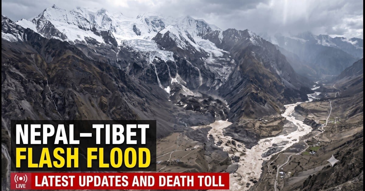
A devastating flash flood struck the Nepal–Tibet border on August 26, sending a powerful surge of water, rock, mud and debris through communities and infrastructure in the Himalayan region. The disaster affected areas around Rasuwa in Nepal and Gyirong in Tibet, destroying roads, bridges, settlements and hydropower facilities.
Three weeks later, rescue and recovery efforts continue, while scientists and authorities work to establish the full sequence of events.
What triggered the disaster?
Early reports suggested that an earthquake may have triggered the collapse and subsequent flooding. However, the U.S. Geological Survey identified the seismic signal as being generated by a massive glacial collapse and debris avalanche.
The event produced seismic energy equivalent to a magnitude 5.2 earthquake. This does not mean that a conventional tectonic earthquake caused the disaster.
Instead, the initial findings point to a chain of connected hazards:
- Glacial collapse involving ice and rock.
- A large debris avalanche and flow.
- Temporary obstruction of a river channel.
- Sudden release of water and debris.
- Catastrophic downstream flooding.
The precise sequence and contribution of each component remain subjects of scientific investigation.
How the flood affected Nepal and Tibet
The flood swept through river corridors near the Nepal–China border, carrying enormous quantities of sediment and debris downstream. In Nepal, the Bhote Koshi–Trishuli river system became a major pathway for the destructive surge.
Roads, bridges, buildings, border facilities and hydropower infrastructure suffered extensive damage. The destruction also complicated rescue operations, communications and access to affected communities.
The disaster affected people travelling through the region, including pilgrims and other visitors near the border crossing. Authorities faced the difficult task of searching for missing people while clearing debris and assessing damaged infrastructure.
Was there a secondary barrier-lake threat?
Yes. Authorities reported the formation of a debris-dammed lake upstream in the affected region. Such a lake can develop when a large mass of rock, ice and sediment blocks a river channel.
The concern is that water accumulating behind the blockage may overflow, erode the barrier or cause a sudden release. Any rapid release could produce another dangerous surge downstream.
Chinese authorities reported that the lake had exceeded approximately 2.5 million cubic metres on August 28. They also warned that additional water could enter the lake. These figures describe the situation during the immediate aftermath and should not be interpreted as current lake levels on September 17.
The latest verified information about the lake’s stability, water level and downstream risk remains essential before issuing a new warning.
Which areas remain important for monitoring?
The Bhote Koshi–Trishuli system connects high-mountain areas with downstream settlements. Communities in parts of Rasuwa, Nuwakot and other downstream districts may face risks from debris, unstable riverbanks and sudden changes in river flow.
Residents should avoid riverbanks, flood channels and areas below unstable slopes. They should follow evacuation instructions and official advisories from Nepal’s authorities.
What does this mean for Himalayan hazard risk?
The disaster highlights the complex risks present in a rapidly changing Himalayan environment. Glacier retreat, ice loss, unstable slopes and changing high-altitude conditions can interact in ways that produce cascading hazards.
ICIMOD has documented substantial glacier loss across the Hindu Kush Himalaya. Its regional assessments show that glacier ice-loss rates have increased significantly in recent decades.
However, regional glacier loss alone does not establish the cause of this specific collapse. Scientists must examine the local glacier, slope conditions, weather, geological structure and other contributing factors.
The event demonstrates why high-mountain hazard monitoring, early-warning systems and resilient infrastructure matter for communities living along vulnerable river corridors.
What happens next?
As of September 16, authorities reported the following figures:
- Deaths: 1,442 — Nepal: 1,399; Tibet: 43.
- Missing: 5,698 — Nepal: 5,179, including 587 foreign tourists; Tibet: 519, including 261 foreigners.
- Rescued: 13,742 people in Nepal, supported by 21,022 security personnel.
- Identified bodies: Only 105 out of more than 1,200 recovered bodies had been identified.
Search-and-rescue operations, debris clearance and infrastructure repair continue. DNA matching is underway to help identify victims. Authorities remain focused on monitoring debris dams, unstable slopes and downstream river conditions.
The August 26 disaster was not a rainfall-driven flood. It was a glacier-related collapse and flood chain involving mass movement, river obstruction and sudden flooding. Understanding this sequence is vital for improving future preparedness across the Himalayas.
WeatherWatch will continue tracking verified updates from scientific agencies and authorities.
Sources
USGS · Nepal Department of Hydrology and Meteorology · ICIMOD · Reuters · Kathmandu Post
This article distinguishes confirmed findings from preliminary assessments. Historical lake measurements and forecasts are not presented as current conditions.