
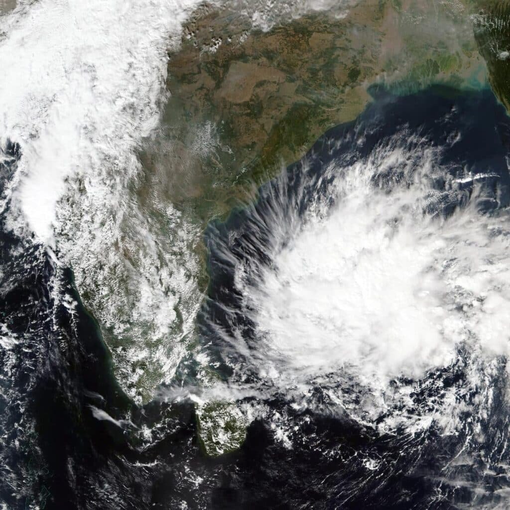
Another weather system is expected to develop over the Bay of Bengal around November 13, 2026, according to the latest outlook from the India Meteorological Department (IMD).
The developing system could become a well-marked low-pressure area within 24 hours of formation as it moves northwestwards. The forecast also indicates squally weather over the Andaman Sea and southeast Bay of Bengal on November 14 and 15.
However, a cyclone has not been confirmed. The immediate development to watch is the formation of the low-pressure area and its subsequent organisation.
The latest outlook comes after Cyclones Arnab and Murasu affected the eastern coastline earlier this month, bringing renewed attention to the Bay of Bengal’s post-monsoon weather activity.
IMD Forecast: Low-Pressure Area Likely Around November 13
In its Tropical Weather Outlook issued on November 10, the IMD reported an upper-air cyclonic circulation over the Gulf of Mannar and adjoining areas.
The circulation extended up to approximately 1.5 km above mean sea level.
Separately, the IMD’s extended-range forecast indicates that another upper-air cyclonic circulation is likely to develop over the southeast Bay of Bengal and adjoining Andaman Sea around November 11.
Under its influence, a low-pressure area is likely to form over the southeast Bay of Bengal around November 13.
The system is then expected to move northwestwards and become a well-marked low-pressure area during the following 24 hours.
These developments are forecasts, not observations of an already formed system.
Could the System Intensify Further?
The possibility of further development remains an important part of the current outlook.
The IMD’s November 10 Tropical Weather Outlook includes probability categories for cyclogenesis, defined in the bulletin as the formation of a depression.
The probability categories increase across the later forecast periods, reaching HIGH in the final 144–168-hour period.
However, this does not mean that a cyclone is certain to develop.
A low-pressure area, a well-marked low-pressure area, a depression and a cyclonic storm represent different stages of atmospheric organisation.
Further development will depend on how the system evolves and the surrounding atmospheric and oceanic conditions.
At this stage, the IMD has forecast the formation of a low-pressure area and its subsequent organisation. It has not confirmed a future cyclonic storm or landfall.
Wind and Sea Conditions: What Has IMD Warned About?
The latest IMD outlook highlights potentially unsettled marine conditions during November 14–15.
According to the November 10 bulletin:
- Wind speed: Squally winds reaching 40–50 km/h, gusting to 60 km/h, are likely.
- Affected waters: Andaman Sea and southeast Bay of Bengal.
- Sea conditions: Rough to very rough conditions are forecast.
- Fishermen’s advisory: Fishermen are advised not to venture into the Andaman Sea and southeast Bay of Bengal on November 14 and 15.
These are forecast conditions associated with the developing weather system. They should not be interpreted as confirmation of cyclone-strength winds.
The IMD may revise these forecasts as the system develops.
Which Areas Could Be Affected?
The southeast Bay of Bengal and adjoining Andaman Sea are the primary areas to monitor during the initial development phase.The system’s forecast northwestward movement will be important in determining its subsequent direction.
However, the final track and any potential landfall location remain uncertain.It is too early to identify Tamil Nadu, Andhra Pradesh, Odisha or West Bengal as confirmed landfall or direct impact locations.
The IMD Kolkata regional outlook issued on November 5 indicated mainly dry weather over South Bengal during November 13–19, with mainly dry conditions also expected over North Bengal apart from isolated rainfall possibilities.
This regional rainfall forecast should not be interpreted as a denitive prediction of the system’s eventual track.Further updates will be necessary before assessing regional impacts.
Why the Bay of Bengal Needs Close Monitoring?
November falls within India’s post-monsoon cyclone season, when tropical weather systems can develop over the Bay of Bengal.The recent development of Cyclones Arnab and Murasu demonstrates the importance of continuous monitoring during this period.
According to the IMD’s November 5 extended-range report, Murasu developed from a low-pressure area over the south Andaman Sea region on October 29.
It intensified into a cyclonic storm on November 1 and reached Severe Cyclonic Storm intensity on November 2 before crossing the south Andhra Pradesh coast on November 3.
The new November 13 system is a separate developing weather feature. Its future intensity and movement must be assessed independently.
What Should Coastal Residents Do?
There is currently no confirmed cyclone landfall forecast associated with the November 13 low-pressure area.
Residents should avoid unnecessary panic but continue monitoring official updates.
- Follow the latest IMD bulletins and regional weather forecasts.
- Fishermen should follow the specific marine advisory for November 14–15.
- Avoid relying on unverified social media posts and isolated model screenshots.
- Coastal administrations should monitor subsequent IMD updates.
- Follow official instructions if warnings or restrictions are issued.
The next few days of observations and updated forecasts will be important in understanding the system’s development.
Frequently Asked Questions
1. Is a cyclone forming in the Bay of Bengal around November 13?
The IMD forecasts a low-pressure area over the southeast Bay of Bengal around November 13. A cyclone has not been confirmed.
2. Will the low-pressure area become a depression?
Further intensification is possible, but it is not guaranteed. The IMD’s probability guidance indicates increasing cyclogenesis potential during the later forecast periods.
3. Which areas are likely to experience strong winds?
The IMD forecasts squally winds of 40–50 km/h, gusting to 60 km/h, over the Andaman Sea and southeast Bay of Bengal on November 14–15.
4. Will Tamil Nadu or Andhra Pradesh face a cyclone landfall?
No specific landfall location has been confirmed. The system’s movement and intensity require further monitoring.
5. Where can people check official cyclone updates?
Follow the India Meteorological Department’s official website and its Regional Specialised Meteorological Centre for Tropical Cyclones, New Delhi.
WeatherWatch Analysis
The November 13 low-pressure system is an important weather development to monitor over the Bay of Bengal.
The IMD has provided a clear initial timeline, including the likely formation of a low-pressure area, northwestward movement and potentially rough marine conditions over the Andaman Sea and southeast Bay of Bengal.
However, the distinction between a developing low-pressure area and a confirmed cyclone remains important.
The system’s organisation over the next several days will determine whether further intensification occurs.
WeatherWatch will continue monitoring official IMD updates as the system develops.
Disclaimer: WeatherWatch is an independent weather news and analysis platform. This article is based on official IMD forecasts available at the time of publication. Forecasts may change with subsequent updates. This information does not replace official weather warnings or government instructions.